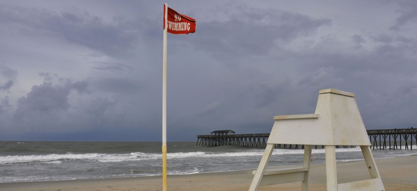
Prepping for a Hurricane That Could Stay for Days

The storm is expected to make landfall in the Carolinas on Friday. National Hurricane Center
Hurricane Florence, a category 4 storm, is the strongest to threaten parts of the East Coast in more than 20 years.
Even for states that engage in seasonal storm preparation every year, Hurricane Florence—a category 4 storm expected to make landfall on the East Coast later this week—presents a challenge.
“It’s different in that there’s really no recent precedent for a storm of this magnitude,” said Allan Libby, head of tourism and public information for the town of Surf City, North Carolina, a 4.2-square-mile stretch of land on the state’s southern coast. “I can safely say the protocols we’re going through are about the same, but everything’s kind of notched up a little bit because we’re relatively certain right now that whatever happens is going to be fairly severe.”
North Carolina has weathered hurricanes in recent years, including Matthew in 2016 (a category 1 storm by the time it made landfall there), Sandy in 2012 (category 2) and Irene in 2011 (category 1). Hurricane Hazel ravaged the state’s coastline as a category 4 storm in 1994, followed by Hurricane Fran (category 3) in 1996. But increased development and evolving technology mean the challenges have changed, Libby noted.
“The world has changed so much since then as far as construction, housing, coastal living, technology,” he said. “It’s really different.”
The advent of social media has been particularly helpful before the storm, Libby said. Across the mid-Atlantic, towns, counties and states have kept up a steady stream of posts about Hurricane Florence, informing residents of new developments and encouraging preparation ahead of time. It’s become a crucial way for officials to reach the people they serve, Libby said, but also for residents to trade information among themselves.
“Social media has an incredibly powerful benefit in times of extreme emergency,” he said. “When the event kicks in people will start cross-posting about where they are and what they’re seeing. It’s a really good example of technology at its best.”
Still, in the storm’s path, traditional baseline preparations—canceling events, keeping residents apprised of the threat—endured. Schools—K-12, universities and colleges—were closed in South Carolina, Virginia and North Carolina. South Carolina Gov. Henry McMaster issued a mandatory evacuation order for almost all of the state’s coastline, while Virginia Gov. Ralph Northam called for residents in the Hampton Roads and Eastern Shore areas to leave. In North Carolina, Gov. Roy Cooper issued the first-ever state-level mandatory evacuation, asking residents of barrier islands to head out immediately. (Standard state protocol calls for those alerts to be triggered at the municipal level, and several coastal counties had already activated mandatory evacuation orders for residents, including New Hanover County, Brunswick County and most of the Outer Banks.)
Residents who ignore those orders are unlikely to be punished by law, but will be left to fend for themselves without the help of public safety officials, who most likely won’t risk the lives of first responders to attend to calls from mandatory evacuation areas during a storm.
For coastal communities, threats from the storm include damage from high wind speeds, storm surge flooding and lengthy power outages. But inland communities could also see torrential rains and heavy flooding, as the storm was expected to slam into a high-pressure system and stall out over North Carolina for several days—an unusual situation, according to Tim Buckley, chief meteorologist for WFMY in Greensboro, a mid-size city in the central part of the state.
“It’s very rare to have a high-pressure system sitting in a roadblock position north of North Carolina during hurricane season, and that’s why this track is so weird,” he said. “Our biggest concern is that it might only move across half of the state over the course of two or three days, so even if it hits the coast on Friday it could still be sitting somewhere in the middle of the state by Monday.”
The storm will weaken once it hits land, particularly in terms of wind speeds, Buckley said. But it will continue to spew rain—from 10 to 20 inches in some places—as it lingers over inland communities.
It’s similar to what happened in Texas last year with Hurricane Harvey. The storm hit well south of Houston and saw its wind speeds decline, then meandered north and sat over the area for days.
“That’s why it was such a disaster for them,” Buckley said. “They never had the hurricane wind, but they had rain for days on end. This is a pretty similar set-up.”
From a preparation standpoint, there’s not much that inland communities can do in advance of flooding beyond engaging in routine storm preparation, said Jake Keys, spokesman for the city of Greensboro. That includes warning residents to stay vigilant and brace for power outages and other storm effects. Officials have also been flushing storm drains and lowering water levels where possible.
“We have released water from Lake Brandt and Lake Townsend to accommodate the rain that’s predicted. Drain clearing and things like that are routine so that when storms are predicted we’re not scrambling,” he said. “It’s fairly routine despite this being a major storm. Honestly, other than releasing water from the lakes, it’s fairly normal. There’s not a lot you can do to prep like you can for snow.”
Kate Elizabeth Queram is a Staff Correspondent for Government Executive’s Route Fifty and is based in Washington, D.C.
NEXT STORY: Mayors Seek to Offset 'Diminished' Federal Role on Climate Change


