A Town Turns to Analytic Modeling—and Data-Sharing—to Improve Flood Monitoring

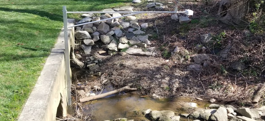
A sensor keeps tabs on water levels in the Walnut Creek stream basin in Cary, N.C. Brad Klenz
The town of Cary, N.C., is launching a new flood-monitoring system that uses analytic modeling to predict near-term flooding. The data is shared with neighboring communities, warning officials that downstream flooding could be heading their way.
For years in Cary, N.C., the municipal system for monitoring stormwater flooding was decidedly low-tech.
“Our visibility, before, typically came from a citizen calling up and telling us that a road was flooded,” said Nicole Raimundo, chief information officer for the Raleigh suburb of about 168,000. “Stormwater overall has become a more prevalent issue over the years, not just in Cary but in other places, because of development.”

The increase in impervious surfaces throughout the town, coupled with an uptick in major rain events, led officials to devise a more technology-driven monitoring system that uses wireless sensors and rain gauges to detect rising water levels in local stream basins. That information is transmitted to a centralized database via a high-speed broadband network dedicated solely to public safety, then sent to a geographic information system that allows town officials to visualize water levels in real time.

The system as a whole also syncs up with the town’s larger Internet of Things platform, which allows for messaging between departments—sending an alert to public works to block off a street, for example—or directly to residents who have opted to receive notifications from the town. The result, Raimundo said, is a streamlined process that simplifies the town’s response effort in the event of a flood.
“We think about the whole process of what happens when something gets flooded, and where we would be doing all these steps that were once manual, it would be an automatic process, triggered by the water levels,” Raimundo said. “It’s about automating the process for us at the town so that we can do things and send the right people at the right time and get the right information out.”
In some cases, that information is also shared with neighboring communities, alerting officials that water levels are rising in Cary and could lead to flooding downstream in the coming hours or days.
“We have a data-sharing framework in place with our neighboring communities, so we can alert, for example, Raleigh that we’re seeing flooding that’s coming their way,” Raimundo said. “It’s really understanding that flooding doesn’t have boundaries.”
To date, there are eight entities in that data-sharing partnership, including the North Carolina Department of Transportation, the state’s Emergency Management department, Wake County and the cities of Raleigh and Wilson. But the framework can expand to accommodate any municipality or agency that wishes to participate, Raimundo said.
“We want to make sure we’re working with our surrounding communities,” she said.
The system is currently in the test phase, compiling water-level data and weather information into a database for historical context. It’s expected to go live in September, generating analytic models that will eventually be able to predict near-term flooding as well as detect anomalies—a branch blocking a culvert, for example—in the stream basin.
“These sensors are being installed for the first time in some of these locations, so there is no historical data for them,” said Brad Klenz, principal architect in advanced analytics research and development at SAS, the software company behind the system. “As we get more, it will make the analytic models more and more accurate.”
If the project works in Cary, Raimundo is hopeful that the technology could benefit cities and towns in coastal areas, where flooding is a more serious—and potentially deadly—problem.
“It’s a model I would love to see taken across the country,” she said. “We know we have flooding in Cary, but there are other communities that are much more flood-prone, so I look at it as something repeatable that we can share out. And luckily for all of them, we’ll have done all the learning.”
Kate Elizabeth Queram is a staff correspondent for Route Fifty and is based in Washington, D.C.
NEXT STORY: Michigan to Pay Flint Residents $600 Million in Water Crisis Settlement


