How one city streamlined emergency evacuations

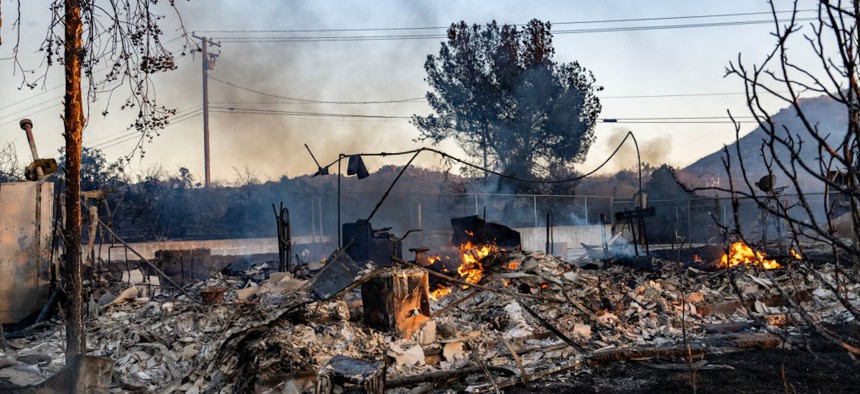
A fire continues to smolder inside the remains of a home in Perris, California, on June 27, 2023. Gina Ferazzi / Los Angeles Times via Getty Images
Officials in Berkeley, California, can send mass messages as well as targeted, zone-based evacuation alerts, cutting the city’s alert time from hours to minutes.
It used to be that when wildfire threatened homes and businesses in Berkeley, California, firefighters had to manually predict the blaze’s path and then go knock on doors to evacuate residents.
Not only would that take hours, but it wasn’t easy to shift their alerting strategy if, say, winds began blowing the flames another way. “It was difficult to pinpoint that one little community or one little section of the city that was threatened,” said Keith May, Berkeley’s deputy fire chief. “If a fire was coming over the hill and it really affected maybe 100 homes, you were sending information out to 1,000 homes…. You had to try your best to define who really was affected.”
Now, the city uses a cloud-based platform to send mass messages as well as targeted, zone-based alerts for all sorts of threats—natural or human-caused.
Residents and businesses are assigned evacuation zones, based on their location’s topography, infrastructure, census data and the nature of the threat. Sending alerts by zones allows officials to target only affected areas and has cut the city’s alert time from hours to minutes, May said.
For example, when a volcanic eruption in Tonga spurred a tsunami that threatened to raise the sea level along Berkeley’s coastline in January 2022, the lead emergency service coordinator or ESC, was able to trigger an alert in just 15 minutes.
“That ESC went into the platform and put the two [tsunami hazard] zones into an alert base, or evacuation base, based on our tsunami alert plan,” May said. “We were able to target those individuals” in those pre-established evacuation zones through Genasys Protect. The software, previously known as Zonehaven Aware, incorporates hyperlocal knowledge to model evolving disasters and their potential impact on evacuation areas, traffic patterns and public safety.
The company works with jurisdictions to develop zones based on population density, road infrastructure and special-needs facilities such as hospitals and nursing homes, which take longer to evacuate, said Richard Danforth, CEO of Genasys, which purchased Zonehaven in June 2021. The technology combines that information with data on weather, wind, humidity, soil type and more.
“The zone creation when we first started was all manual,” Danforth said. “But we’ve created software tools that take data from sources that are available and does about 90% of the work. The last 10% we typically try to do with the customer. The customer has more discrete knowledge of the area than what might be on a map or what might be in a public database.”
Using that data, the software runs models on flooding, avalanche, active-shooter and other situations,” Danforth said. It gives responders an expected propagation path so that they can “use the zones that we created for them to send a message to phones or through acoustic devices, radios, TVs, social media that it’s time to go,” he added.
A key aspect of the modeling is intelligent mass notification, he said. It provides information on the number of vehicles on evacuation routes and can be updated in real time if something changes to shift the threat.
The technology includes a public-facing app that residents can opt into to receive alerts. Because the app is voluntary, May said responders also use other alerting mechanisms. They include AC Alert, Alameda County cities and counties’ mass notification system, and Nixle, an open communication forum that connects public safety offices, municipalities, schools, businesses and communities. Officials also still go door to door.
The ability to alert by zone is game-changing, May said. Previously, officials had to contact responders, set up a unified command post, determine which areas should be evacuated then go door-to-door to alert residents.
To use Genasys Protect, the city incorporated zones that responders had established about 13 years ago to expedite emergency medical services, but there were still some tweaks. For instance, for the marina area, the fire department collaborates with the U.S. Geological Survey on tide tables and liquefaction areas, or regions where groundwater conditions make the soil unstable during an earthquake. “We didn’t want to just evacuate all the west end if we didn’t need to” during a hazard, May said. “We were able to draw in zones around the marina in that liquefaction area…. That was really key.”
Broad-based emergency alerts aren’t new. State and local authorities use the national Emergency Alert system to deliver AMBER alerts and other critical information. The Wireless Emergency Alerts system launched in 2012 and has been used more than 78,000 times, according to the Federal Communications Commission. It enables officials to target specific geographic areas, but not as granularly as Genasys Protect.
Stephanie Kanowitz is a freelance writer based in northern Virginia.


