Virginia Beach Is Using an IoT-Enabled Sensor Network to Predict Flooding in Real Time

Virginia Beach, Virginia
Local officials are hoping high-resolution, hydrodynamic models using fluid physics will improve preparedness and response in a low-lying region vulnerable to flooding.
Virginia Beach, Virginia is looking to predict the timing and severity of flooding at street level in a year’s time through the StormSense Project, a multi-jurisdictional effort working to improve regional resiliency and enhance disaster preparedness efforts.
In 2016, the city participated in the Obama administration’s Global City Teams Challenge with the goal of preparing Virginia’s most-populous city for the impacts of rising sea-levels with replicable, measurable projects other flood-vulnerable jurisdictions could scale at cost.
A successful inundation-forecasting research initiative capable of anticipating flooding from storm surge, rain and tides would require a network of water-level sensors, which the city lacked at the time.
“From a mathematical side, our goal is dealing with flooding,” Jon Loftis, StormSense Project manager for the greater Hampton Roads region and Virginia Institute of Marine Science assistant research scientist, told Route Fifty by phone.
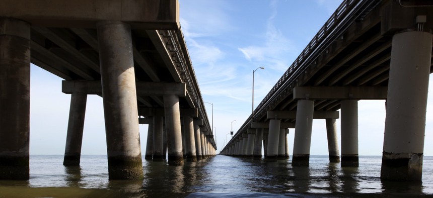
VIMS partnered on the project with Virginia Beach, seven neighboring jurisdictions and the state Department of Health among other stakeholders to develop flood modeling making use of bridge-mounted, Internet of Things-enabled, mostly ultrasonic sensors tracking water levels in the various rivers, bays, inlets and estuaries that form the low-lying Hampton Roads region.
The high-resolution, hydrodynamic models—those that solve flood-related problems using fluid physics—also rely on crowdsourced data verified by post-flood analysis and atmospheric weather data for predictions.
The city quickly realized Amazon Web Services’ cloud was the best way to combine data streams coming in from so many disparate sources: the U.S. Geological Survey; the National Oceanic and Atmospheric Administration; local water and sewer authorities; and newly installed sensors, Sridhar Katragadda, Virginia Beach Information Technology systems analyst, told Route Fifty by phone.
A StormSense prototype was completed allowing for online review of maps and data, as well as mobile access so sensors connected to Alexa can be queried in real-time about the water level at their location. Predictive analysis is the next step, Katragadda said, but more data is needed and flood levels need to be defined for each sensor.
Sensors remain sparsely spaced throughout the region with some as far as eight to 12 miles from the nearest estuary. The topography throughout remains flat. So it doesn’t take a lot to flood the region, and floodwaters often flow, literally, wherever the wind blows.
“Streets end up being counduits for fluid flow,” Loftis said. ‘The nearest gauge is not particularly telling of what with happen in your particular leg of the river.”
Virginia Beach stuck with low-cost sensors lacking the federal standard satellite uplink, instead relying on long-range Wi-Fi or cellular signals, and its cellular broadband provider differs from other cities in the region. Most of the sensors are ultrasonic—short range, high frequency sonar devices—that measure the distance from the bridge piling they’re mounted on to the water’s edge.
VIMS is testing different technologies for interpreting the data and providing logistical feedback on what information to share with the public, with plans to install three more sensors to bring the total up to 28 in the region. Virginia Beach supplies 10 of those with 10 more on the way, the initial StormSense pilot helping to determine how many more are needed and where to estimate costs.
The city hopes others will adopt its model so that one day all communities in the region can inform residents in real-time whether or not they need to move their cars from the streets to parking garages ahead of flooding or the proper evacuation route to take based on wind patterns.
Katragadda said the city is working on further advances like two-sensor initiation, where flood sensors on the ground remain dormant until rainfall sensors above ground detect precipitation and trigger them to turn on.
Amazon Web Services showcased cameras recently with machine learning capabilities that could be mounted next to sensors for an added perspective of what’s happening in the water in the event of an anomaly, like a branch floating under a sensor. Image analysis will only improve the StormSense model.
Dave Nyczepir is a News Editor at Government Executive’s Route Fifty and is based in Washington, D.C.
NEXT STORY: AI and chatbots: Driving the future of government IT service management


