A Maryland County Uses Interactive Maps to Design Bicycle Master Plan

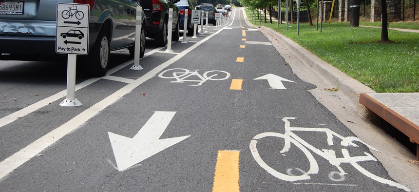
A two-way separated bike lane in White Flint, Maryland. Montgomery County Planning Department
COMMENTARY | Montgomery County's maps are expected to guide recommendations to improve cycling in the area. Planners evaluated 3,500 miles of roads and reached out to a diverse group of residents for input.
Many cyclists are fed up with sharing dangerous roads with cars, demanding local governments design more comfortable bike lanes that provide better protection for riders. Leading cities and counties are responding to the call not only to reduce traffic accidents, but also to attract and retain residents and businesses that have come to expect better transportation amenities.
But the development of protected bike lanes and other roadway infrastructure can be a costly, time-consuming process. As local governments prioritize which projects to begin first, they must weigh the demands of riders of varying risk tolerances against considerations like cost and ease of implementation.
Next month, the Montgomery County Council will hold a public hearing about its draft Bicycle Master Plan. According to the Maryland-National Capital Park and Planning Commission, the document will “set forth a vision for Montgomery County as a world-class bicycling community, where people in all areas of the County have access to a comfortable, safe and connected bicycle network, and where bicycling is a viable transportation option that improves our quality of life.”
The recommendations of the Bicycle Master Plan are based on years of public outreach and data-driven research. Throughout the development of the Plan, the Park and Planning Commission sought to understand the effectiveness of the county’s existing infrastructure as perceived by different kinds of cyclists—from those who stick to the quietest backroads to most adventurous commuters.
“Any change comes from the public, and we’re trying to respond to the desire of our residents to have high-quality bicycling networks that are going to make others want to live in Montgomery County,” said David Anspacher, the planner coordinator at Maryland-National Capital Park and Planning Commission. Anspacher and his team have listened to public requests for better biking networks, and they’ve characterized that demand through a series of interactive maps.
The Planning Commission started their multi-year process with the Bike Stress Map, which they launched in April 2016. The Planning Commission evaluated 3,500 miles of road in Montgomery County, using nearly thirty data attributes to characterize each segment. The resulting map color codes each route according to how stressful it is to cyclists of various risk-tolerance levels.

Using the Bike Stress Map, one can gauge how well connected various amenities are for cyclists. For example, one can see that 26% of dwelling units are connected to Wayside Elementary School via a low-stress bicycle network. Through this function, the map also reveals critical disconnects between cycling networks and public transit that, if fixed, could become important linkages in Montgomery County’s mobility ecosystem.
After the Bike Stress Map, the Planning Commission released the Bikeway ReactMap, which illustrated the county’s preliminary bikeway recommendations and enabled residents to provide feedback. The purpose of the ReactMap was to get feedback from the public and determine the final recommendations that would go into the Bicycle Master Plan. In addition to illustrating where trails, bikeways, bikeable shoulders, and shared roads exist in Montgomery County, the ReactMap also showed where proposed interventions were planned. The map received over 1,500 comments.
One of the many challenges with developing interactive maps is that they often disproportionately appeal to a tech-savvy, often more affluent demographic. To solicit engagement and input into the Bike Stress Map and ReactMap from a diverse group of people, the Planning Commission used a mix of traditional, community-meeting style outreach as well as social media and emails. The interactive maps were optimized for mobile devices, allowing a wider audience to weigh in. The Planning Commission invested in Spanish translation and key advertising at bus stops and Metrorail stations to drive traffic to the website. The Bikeway ReactMap received comments from more than 400 unique users who analyzed and commented on the existing roadways and planned infrastructure.
As Montgomery County looks to the future, they anticipate that new infrastructure will increase bicycling rates in the County, remove crucial blockages that separate low-stress cycling networks, expand the equity as to where bike infrastructure is developed, and reduce the number of bicycle-related accidents. Currently, 14 percent of trips can be made on low-stress roads and paths in Montgomery County. The new plan aims to increase that share to 55 percent by 2043.
Wyatt Cmar is a research assistant and writer for the Project on Municipal Innovation Advisory Group at the Ash Center for Democratic Governance at the Harvard Kennedy School of Government
NEXT STORY: Ohio plans to integrate drones into traffic management


