Flood management gets a boost from drones

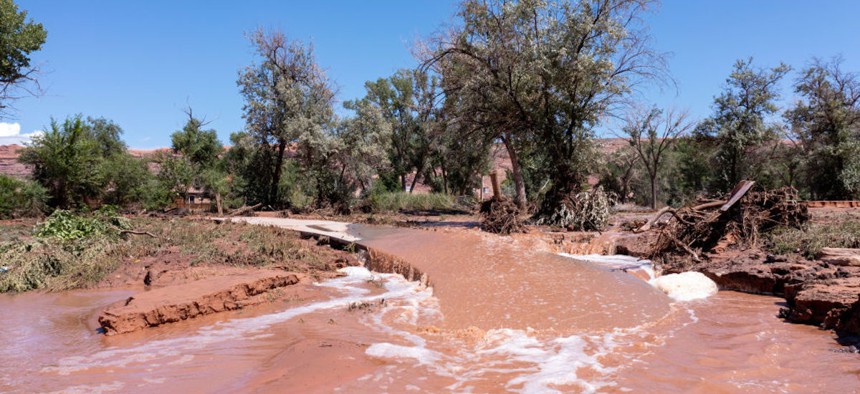
Floodwaters overflow the Mill Creek Parkway after a flash flood in Moab, Utah, in August 2022. Jon G. Fuller/VW Pics/Universal Images Group via Getty Images
As major flooding events are expected to become more common, drones could help communities keep resilience up and damage down.
Managing floods first requires knowing where flooding will likely occur. But manually surveying rising waters can be a timely and costly endeavor, not to mention a safety risk for the people who gather that data.
Many state and local governments already leverage tools such as satellite imagery or historic flood data to understand where and how floodwaters affect their communities, but one expert says managers must tap into new tools to stay afloat in the changing flood management landscape.
Drones could be the future of flood management, said Ian Gowing, a research engineer at the Utah Water Research Laboratory and manager of the lab’s AggieAir Unmanned Aerial System Service Center. Gowing and drone pilot Austin Washke recently partnered with two Utah cities—Logan and Nibley—to test the capabilities of drones for improved flood management and monitoring.
One advantage of drones, Gowing said, is that they’re relatively inexpensive to deploy and can produce higher resolution images than satellites. “You’re able to pick out features on the ground that you wouldn’t necessarily see using satellite imagery,” he said.
Drones can also survey how well prevention measures hold up during flood events. That’s why Logan enlisted Gowing’s help during a major flood in May, the city’s engineer and flood manager Darren Farar said.
Springtime flooding is not new for Logan, he said. During the winter, snow that builds up on mountains—also known as snowpacks—annually melts into runoff that often floods nearby cities. But this year, Utah saw record-breaking levels of snow and, ultimately, more flooding than Logan expected.
Over the last 30 years, according to Utah’s Department of Natural Resources, the median snowpack height measured 15.8 inches. This year’s snowpack clocked in at just over 30 inches, the Natural Resources Conservation Service reported in April.
On May 25, Logan Mayor Holly Daines declared a state of emergency for the city due to flooding of the Logan River. The river is considered in a minor flood stage once floodwaters reach 5.2 feet deep and a major flood state at 6 feet. At the time the emergency declaration was signed, Logan River flooding was reported to be 5.34 feet and expected to reach 6 feet within days.
Just one day before the city entered a state of emergency, Gowing and Washke piloted a drone to follow the river’s path. Over five flight sessions that spanned 19 miles, drone imagery revealed how the floodwaters affected surrounding neighborhoods, farmland and grassland.
The drone insights supplemented by the city’s available flood data “helps us to see whether that flood is where we expected it to be, or if it was expanded or less in different areas,” Farar said.
Plus, data collected from drones during a flood can help finetune flood predictions and modeling. With more accurate and timely data, policymakers can then implement better data-driven flood prevention measures. “If [a community has] a parcel of land that hasn’t already been developed … and somebody wants to develop it into residential homes,” Gowing said, “this imagery allows the city to understand the potential of any flooding that may occur there.”
Ultimately, the drone flights helped put some of Logan’s concerns to rest. While May’s flooding marked the largest river flow recorded since 1986, water levels were not as high as officials expected, according to Utah State University. Plus, in an effort to prevent river overflow, the city lined the riverbank with sandbags. The drone imagery indicated those efforts made a difference as data showed there was minimal overflow.
Logan’s success in managing the flood and using drones to monitor the river levels could help reduce flood insurance prices for residents, Farar said. Since the 1990s, the city has been a part of the Federal Emergency Management Agency’s Community Rating System, which is a program that allocates discounts on property owners’ flood insurance premiums if a community can prove its commitment to flood management practices.
The system rates the effectiveness of communities’ flood mitigation efforts using credit points. The more points earned, the higher the discounts property owners can receive. Communities can earn points by submitting documentation of their flood management efforts to FEMA. Logan is categorized as Class 7, Farar said, which qualifies property owners for a 15% discount. The highest discount rate available is 45%.
The Community Rating System motivates city managers to invest in the necessary infrastructure, policies and services to mitigate flood risks. “We’re able to better manage our floodplains and give good direction to developers or property owners,” Farar said, “and be a better steward and manager of those floodplains within the city.”
NEXT STORY: Emergency financial aid can prevent homelessness


